
Rain showers and mountain snow should return to the area early next week. Computer projections have been consistent over the past few days, which gives me some confidence with this forecast.
Isolated light showers are possible Monday through early Tuesday. Snow levels will range from 9,000 feet to 10,000 feet during this time period.
The core of the system will then settle in late Tuesday and bring more scattered showers to the area. Snow levels will rapidly drop to 4,000 to 5,000 feet Tuesday night. Some isolated areas could be lower.
Intermittent showers and mountain snow will persist through early Wednesday, then taper by Wednesday evening.
Unfortunately, there won't be much moisture associated with this system - the atmospheric river will be almost nonexistent. This will limit the rain potential, but we'll take whatever we can get! It will also be nice to see some snow in our local mountains.
I've included the computer projections for total rain and snow below. These totals are heavily dependent on the track of this system, so I will bring updates if/when needed.
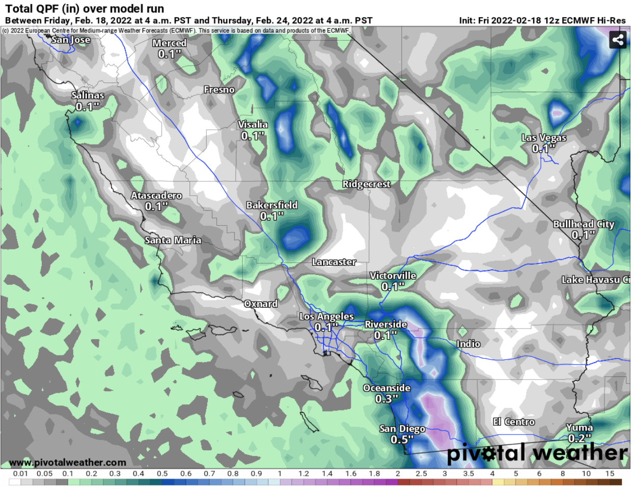 |
| Computer projected rainfall through next Thursday morning |
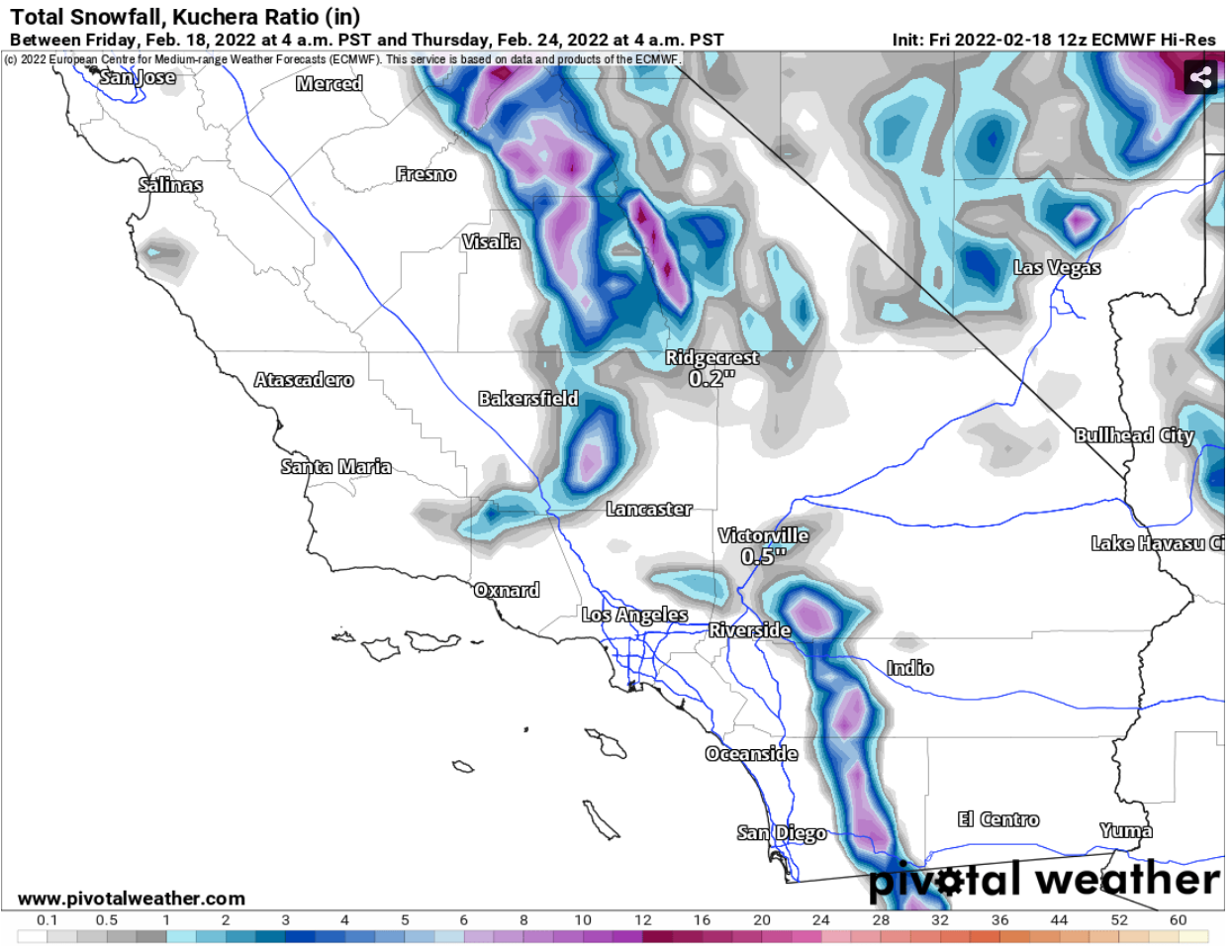 |
| Computer projected snowfall through next Thursday morning |


No comments:
Post a Comment