Our next storm system is currently nestling into the Pacific Northwest - seen on the satellite loop below. Some patches of drizzle or light rain will develop on Monday, but most of the day should be dry.
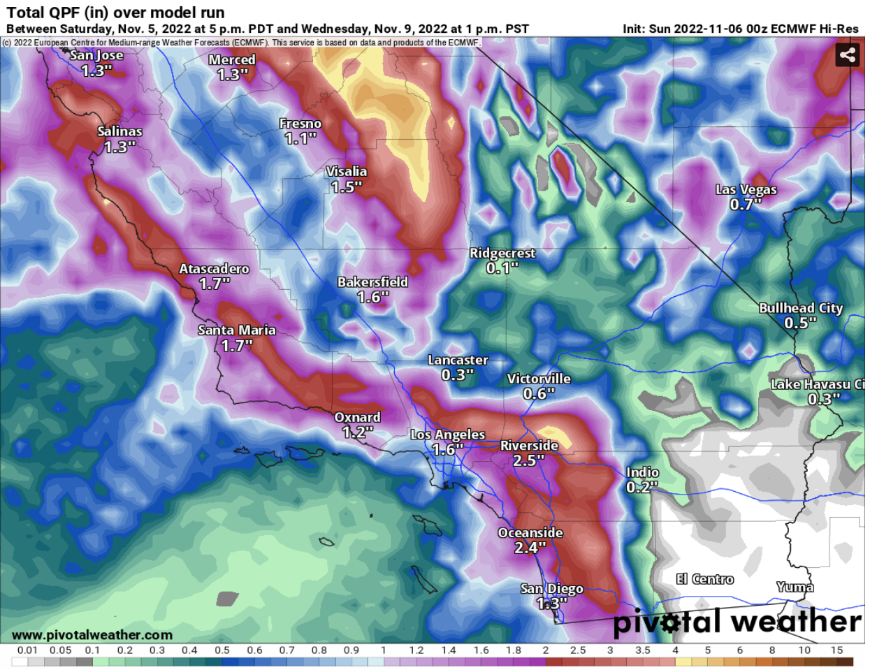
Rain will then overspread the area on Tuesday and will persist intermittently through Wednesday morning. Rain chances quickly diminish by Wednesday afternoon. I've posted the computer projected rain totals below, which show 1-3" for coastal and inland areas and 3-4" for the mountains.
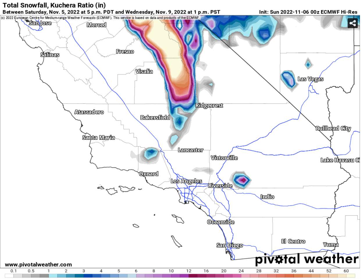
Snow levels will stay high through this event. On Tuesday they will be above 9,000 feet, then drop to 6,000 feet early Wednesday as the storm exits. This could bring a brief period of snow for the highest peaks in San Diego County, but significant snow for taller mountains to the north. I've posted the projected snow totals below.


