
As always, visit the National Weather Service for all the latest weather advisories and warnings in our area. Stay safe!
https://www.weather.gov/sgx/
Wednesday Afternoon
Showers will approach from the north around noon today. This rainfall will persist into the early evening. Winds 15-25, up to 40 in the mountains. Snow levels 6,000-7,000.
Wednesday Night
Intermittent showers. Winds 5-15, up to 30 in the mountains. Snow levels 5,000 to 6,000 feet.
Thursday Morning
Rain with embedded downpours and isolated thunderstorms will overspread the area starting at 5-6 AM. Winds 25-35, gusts up to 55 in the mountains. Snow levels 5,000 to 6,000 feet.
Thursday Afternoon
Rain with isolated downpours/thunderstorms move through the area. Showers will become more intermittent by the evening. Winds 15-25, gusts up to 50 in the mountains. Snow levels 4,500 to 5,500 feet.
Thursday Night
Periods of rain, occasional downpour possible. Winds 15-25, gusts up to 50 in the mountains. Snow levels 3,500 to 4,500 feet.
Friday Morning
Lingering showers. Winds 10-20, gusts up to 45 in the mountains. Snow levels 3,000 to 4,000 feet.
Friday Afternoon
Isolated showers. Winds 15-25, gusts up to 50 in the mountains. Snow levels 3,500 to 4,500 feet.
Friday Night
Rain chance diminishes. Winds 5-15, gusts up to 40 in the mountains. Snow levels 3,500 to 4,500 feet.
 |
| Computer projected rain totals from this storm system |
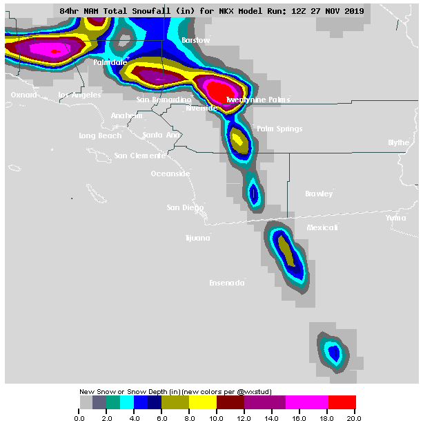 |
| Computer projected snow totals from this storm system |


No comments:
Post a Comment