ADVERTISEMENT

NEXT RAIN CHANCE SAN DIEGO: UPDATED SAT 10/31/2015

The next storm system still looks on track. You can see it spiraling off the Canadian West Coast on the satellite loop below. We will see a surge of warm air ahead of the system today and Sunday.

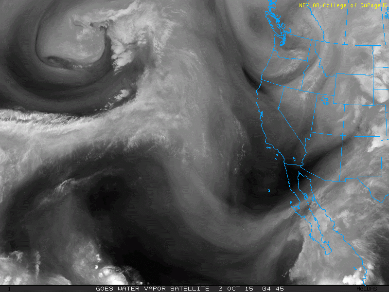
A powerful cold front will then sweep through the area for the first half of the workweek. A few intermittent showers and possibly a quick downpour will be possible Monday through Wednesday, however, it doesn't look like a major rain event.

Also expect breezy conditions and cooler weather. Highs will remain in the mid to upper 60s. Thursday morning will be the coolest, where temperatures will dip into the 40s!

I'll have more updates in the coming days.


NEXT RAIN CHANCE SAN DIEGO: UPDATED TUE 10/27/2015

A small fast-moving storm system will pass the area late Wednesday into early Thursday. This will bring clouds and a slight chance for isolated showers (20%). High temperatures will briefly drop into the 70s Thursday, then bounce back to the 80s for Friday and Saturday.

I'm keeping my eye on a bigger system that is headed this way for the start of next workweek. It doesn't look like a major rain event, however, a few showers will be possible. The biggest impact of this system will be the cooler weather. High temperatures will drop into the mid 60s to low 70s from Monday through Thursday. We will also see an increase in winds.

 I'll bring more updates in the coming days!

NEXT RAIN CHANCE SAN DIEGO: UPDATED THU 10/22/2015

Computer forecasts are becoming more consistent with our next rain potential. It's looking like a storm system will move out of the Gulf Of Alaska and into our area around October 28-29. This is still far into the future, so there could be changes in the timing and strength of this system. Regardless, it's the best chance we've got for rain in the next ten days.


SAN DIEGO RAIN TOTALS: FRI 10/16/2015


WEATHER UPDATE: FRIDAY 10/16/2015

Isolated light showers and patchy drizzle will move through the area today, especially in the morning. Unfortunately, rain totals won't amount to much. Luckily it will keep things cool! More patches of mist/drizzle could form tonight.

NEXT RAIN CHANCE SAN DIEGO: UPDATED TUE 10/13/2015

As I mentioned in my last blog entry, the storm system that brought us rain last week has retrograded. It is now spiraling off the coast of the Baja and Southern California. It will bring a chance for isolated showers for the next few days, especially on Thursday.

Unfortunately this system is moisture-starved, so rain totals will be subdued.
Regardless, we'll take what we can get! In addition, the cloud cover will help taper some of the heat.

SAN DIEGO COUNTY HIGH TEMPERATURES: 10/11/2015

: ID :      STATION           ELEV : HIGH / LOW /  PCPN / SNODEP
:                             FEET                        INCHES
:
:        ...COASTAL AREAS...
:
YBLC1:      YORBA LINDA        350 :  101 /  70 /  0.00 /
FUL  :      FULLERTON AIRPORT   96 :  100 /  70 /  0.00 /
ANAC1:    * ANAHEIM            335 :  102 /  75 /  0.00 /
STAC1:      SANTA ANA          135 :   98 /  71 /  0.00 /
SDHTB:      HUNTINGTON BEACH     5 :   89 /  66 /  0.00 /
SNA  :      JOHN WAYNE AIRPORT  55 :   94 /  71 /  0.00 /
3L3  :    * NEWPORT BEACH       10 :   87 /  70 /  0.00 /
LAGC1:      LAGUNA BEACH        35 :   95 /  67 /  0.00 /
SDDPC:      DANA POINT         305 :   89 /  70 /  0.00 /
SDFRH:      LAKE FOREST        970 :   99 /  77 /  0.00 /
L34  :      OCEANSIDE HARBOR    10 :   82 /  70 /  0.00 /
OKB  :      OCEANSIDE AIRPORT   28 :   91 /  65 /  0.00 /
SDVIS:      VISTA              330 :   99 /  69 /  0.00 /
CRQ  :      CARLSBAD AIRPORT   328 :   90 /  70 /  0.00 /
SDETS:      ENCINITAS          270 :   93 /  68 /  0.00 /
SOL  :      SOLANA BEACH        75 :   84 /   M /  0.00 /
SDDMB:      DEL MAR BEACH       10 :   80 /  68 /  0.00 /
NKX  :      MIRAMAR            477 :    M /  71 /  0.00 /
MYF  :      MONTGOMERY FIELD   420 :   98 /  70 /  0.00 /
SAN  :      SAN DIEGO           15 :   94 /  73 /  0.00 /
L13  :      CABRILLO NATL MNMT 364 :   90 /  74 /  0.00 /
SDNAC:      NATIONAL CITY       25 :   94 /  69 /  0.00 /
SDCHU:      CHULA VISTA        120 :   95 /  66 /  0.00 /
NRS  :      IMPERIAL BEACH      23 :   88 /  64 /  0.00 /
SDM  :      BROWN FIELD        525 :   94 /  67 /  0.00 /
:
:        ...INLAND AREAS...
:
ONT  :      ONTARIO            943 :   98 /  70 /  0.00 /
CNO  :      CHINO              652 :  101 /  64 /  0.00 /
SDALO:      RANCHO CUCAMONGA  1940 :   96 /  76 /  0.00 /
SDSBO:      SAN BERNARDINO    1050 :   98 /  67 /  0.00 /
AJO  :      CORONA             531 :    M /   M /     M /
RAL  :      RIVERSIDE AIRPORT  818 :  100 /  69 /  0.00 /
UCRC1:      RIVERSIDE          986 :  102 /  65 /  0.00 /
RIV  :      RIVERSIDE MARCH   1542 :   96 /  61 /  0.00 /
BUO  :      BEAUMONT          2680 :   92 /  65 /  0.00 /
SDLEL:      ELSINORE          1275 :   99 /  63 /  0.00 /
SDHET:      HEMET             2050 :   98 /  70 /  0.00 /
SDTEC:      TEMECULA          1020 :   97 /  64 /  0.00 /
SDFBK:      FALLBROOK          698 :   99 /  74 /  0.00 /
SDSMP:      SAN MARCOS         630 :   97 /  75 /  0.00 /
ESCC1:      ESCONDIDO          645 :   99 /  68 /  0.00 /
PSQC1:      SAN PASQUAL VALLEY 255 :  101 /  58 /  0.00 /
RNM  :      RAMONA AIRPORT    1393 :   97 /  59 /  0.00 /
SGX  :      RANCHO BERNARDO    690 :   96 /  72 /  0.00 /
SDPOY:      POWAY              597 :  101 /  64 /  0.00 /
ALPC1:      ALPINE            1695 :   93 /  67 /  0.00 /
SDLAM:      LA MESA            500 :   97 /  74 /  0.00 /
SDSNL:      SANTEE             435 :  100 /  65 /  0.00 /
ELJC1:    * EL CAJON           405 :  100 /  67 /  0.00 /
SDRSC:      RANCHO SAN DIEGO   400 :   98 /  67 /  0.00 /
LMGC1:      LEMON GROVE        427 :   97 /  71 /  0.00 /
:
:        ...MOUNTAIN AREAS...
:
ECSC1:      EL CARISO         2730 :   92 /  74 /  0.00 / 
WRIC1:      WRIGHTWOOD        5980 :   76 /  54 /  0.00 / 
SDARN:      LAKE ARROWHEAD    5180 :   81 /  60 /  0.00 / 
BBLC1:    * BIG BEAR LAKE     6768 :   73 /  43 /  0.00 / 
SDBDN:      BALDWIN LAKE      6770 :   72 /  37 /  0.00 /
SDAOK:      ANGELUS OAKS      5800 :   78 /  54 /  0.00 /
SDPCV:      PINE COVE         6299 :   76 /  58 /  0.00 /
IDYC1:      IDYLLWILD         5380 :   83 /  49 /  0.00 / 
NZAC1:      ANZA              3939 :   85 /  56 /  0.00 / 
PYNC1:      PINYON PINES      4060 :   88 /  57 /  0.00 / 
PLRC1:    * PALOMAR MOUNTAIN  5550 :   77 /  60 /  0.00 / 
JULC1:      JULIAN            4240 :   81 /  59 /  0.00 / 
MLNC1:    * MOUNT LAGUNA      5920 :   73 /  55 /  0.00 / 
CZZ  :    * CAMPO COOP        2615 :   90 /  58 /  0.00 / 
:
:        ...DESERT AREAS...
:
HESC1:    * HESPERIA          3055 :   90 /  65 /  0.00 / 
APLC1:      APPLE VALLEY      2780 :    M /   M /     M / 
PSP  :      PALM SPRINGS       425 :  100 /  74 /  0.00 / 
IDOC1:      INDIO              -21 :    M /   M /     M / 
TRM  :      THERMAL           -117 :   94 /  61 /  0.00 / 
BROC1:      BORREGO            805 :   97 /  73 /  0.00 / 
OCWC1:      OCOTILLO WELLS     390 :   95 /  73 /  0.00 / 
TYEC1:      JOSHUA TREE N.P.  1975 :   95 /  67 /  0.00 / 
BLH  :      BLYTHE             397 :   99 /  71 /  0.00 /
IPL  :      IMPERIAL           -56 :  101 /  69 /  0.00 /

SAN DIEGO COUNTY HIGH TEMPERATURES: 10/10/2015

: ID :      STATION           ELEV : HIGH / LOW /  PCPN / SNODEP
:                             FEET                        INCHES
:
:        ...COASTAL AREAS...
:
YBLC1:      YORBA LINDA        350 :  105 /  74 /  0.00 /
FUL  :      FULLERTON AIRPORT   96 :  103 /  73 /  0.00 /
ANAC1:    * ANAHEIM            335 :  104 /  75 /  0.00 /
STAC1:      SANTA ANA          135 :  103 /  75 /  0.00 /
SDHTB:      HUNTINGTON BEACH     5 :   99 /  65 /  0.00 /
SNA  :      JOHN WAYNE AIRPORT  55 :  100 /  72 /  0.00 /
3L3  :    * NEWPORT BEACH       10 :   92 /  74 /  0.00 /
LAGC1:      LAGUNA BEACH        35 :   96 /  69 /  0.00 /
SDDPC:      DANA POINT         305 :   98 /  75 /  0.00 /
SDFRH:      LAKE FOREST        970 :  100 /  77 /  0.00 /
L34  :      OCEANSIDE HARBOR    10 :   97 /  74 /  0.00 /
OKB  :      OCEANSIDE AIRPORT   28 :   99 /  63 /  0.00 /
SDVIS:      VISTA              330 :   99 /  71 /  0.00 /
CRQ  :      CARLSBAD AIRPORT   328 :  100 /  80 /  0.00 /
SDETS:      ENCINITAS          270 :   97 /  78 /  0.00 /
SOL  :      SOLANA BEACH        75 :   93 /   M /  0.00 /
SDDMB:      DEL MAR BEACH       10 :   92 /  78 /  0.00 /
NKX  :      MIRAMAR            477 :    M /  77 /  0.00 /
MYF  :      MONTGOMERY FIELD   420 :   99 /  75 /  0.00 /
SAN  :      SAN DIEGO           15 :   96 /  77 /  0.00 /
L13  :      CABRILLO NATL MNMT 364 :    M /   M /     M /
SDNAC:      NATIONAL CITY       25 :   92 /  72 /  0.00 /
SDCHU:      CHULA VISTA        120 :   94 /  73 /  0.00 /
NRS  :      IMPERIAL BEACH      23 :   92 /  72 /  0.00 /
SDM  :      BROWN FIELD        525 :   97 /  73 /  0.00 /
:
:        ...INLAND AREAS...
:
ONT  :      ONTARIO            943 :  100 /  70 /  0.00 /
CNO  :      CHINO              652 :  101 /  64 /  0.00 /
SDALO:      RANCHO CUCAMONGA  1940 :   95 /  75 /  0.00 /
SDSBO:      SAN BERNARDINO    1050 :   98 /  70 /  0.00 /
AJO  :      CORONA             531 :    M /   M /     M /
RAL  :      RIVERSIDE AIRPORT  818 :  100 /  70 /  0.00 /
UCRC1:      RIVERSIDE          986 :  102 /  68 /  0.00 /
RIV  :      RIVERSIDE MARCH   1542 :   96 /  62 /  0.00 /
BUO  :      BEAUMONT          2680 :   89 /  67 /  0.00 /
SDLEL:      ELSINORE          1275 :  100 /  64 /  0.00 /
SDHET:      HEMET             2050 :    M /   M /  0.00 /
SDTEC:      TEMECULA          1020 :   97 /  65 /  0.00 /
SDFBK:      FALLBROOK          698 :   99 /  74 /  0.00 /
SDSMP:      SAN MARCOS         630 :   99 /  78 /  0.00 /
ESCC1:      ESCONDIDO          645 :  100 /  70 /     M /
PSQC1:      SAN PASQUAL VALLEY 255 :  101 /  62 /  0.00 /
RNM  :      RAMONA AIRPORT    1393 :   95 /  61 /  0.00 /
SGX  :      RANCHO BERNARDO    690 :   98 /  74 /  0.00 /
SDPOY:      POWAY              597 :  102 /  66 /  0.00 /
ALPC1:      ALPINE            1695 :   93 /  69 /  0.00 /
SDLAM:      LA MESA            500 :   98 /  75 /  0.00 /
SDSNL:      SANTEE             435 :  102 /  67 /  0.00 /
ELJC1:    * EL CAJON           405 :  100 /  69 /  0.00 /
SDRSC:      RANCHO SAN DIEGO   400 :   98 /  71 /  0.00 /
LMGC1:      LEMON GROVE        427 :   99 /  78 /  0.00 /
:
:        ...MOUNTAIN AREAS...
:
ECSC1:      EL CARISO         2730 :   92 /  76 /  0.00 / 
WRIC1:      WRIGHTWOOD        5980 :   75 /  54 /  0.00 / 
SDARN:      LAKE ARROWHEAD    5180 :   78 /  55 /  0.00 / 
BBLC1:    * BIG BEAR LAKE     6768 :   72 /  44 /  0.00 / 
SDBDN:      BALDWIN LAKE      6770 :   72 /  39 /  0.00 /
SDAOK:      ANGELUS OAKS      5800 :   76 /  56 /  0.00 /
SDPCV:      PINE COVE         6299 :   74 /  58 /  0.00 /
IDYC1:      IDYLLWILD         5380 :   81 /  54 /  0.00 / 
NZAC1:      ANZA              3939 :   83 /  68 /  0.00 / 
PYNC1:      PINYON PINES      4060 :   85 /  55 /  0.00 / 
PLRC1:    * PALOMAR MOUNTAIN  5550 :   76 /  60 /  0.00 / 
JULC1:      JULIAN            4240 :   78 /  62 /  0.00 / 
MLNC1:    * MOUNT LAGUNA      5920 :   71 /  55 /  0.00 / 
CZZ  :    * CAMPO COOP        2615 :   88 /  54 /  0.00 / 
:
:        ...DESERT AREAS...
:
HESC1:    * HESPERIA          3055 :   89 /  61 /  0.00 / 
APLC1:      APPLE VALLEY      2780 :    M /   M /     M / 
PSP  :      PALM SPRINGS       425 :   99 /  76 /  0.00 / 
IDOC1:      INDIO              -21 :    M /   M /     M / 
TRM  :      THERMAL           -117 :  100 /  67 /  0.00 / 
BROC1:      BORREGO            805 :   95 /  77 /  0.00 / 
OCWC1:      OCOTILLO WELLS     390 :   95 /  77 /  0.00 / 
TYEC1:      JOSHUA TREE N.P.  1975 :   92 /  68 /  0.00 / 
BLH  :      BLYTHE             397 :   99 /  76 /  0.00 /
IPL  :      IMPERIAL           -56 :  101 /  71 /  0.00 /

SAN DIEGO COUNTY HIGH TEMPERATURES: 10/9/2015

: ID :      STATION           ELEV : HIGH / LOW /  PCPN / SNODEP
:                             FEET                        INCHES
:
:        ...COASTAL AREAS...
:
YBLC1:      YORBA LINDA        350 :  106 /  66 /  0.00 /
FUL  :      FULLERTON AIRPORT   96 :  105 /  68 /  0.00 /
ANAC1:    * ANAHEIM            335 :  104 /  68 /  0.00 /
STAC1:      SANTA ANA          135 :  106 /  68 /  0.00 /
SDHTB:      HUNTINGTON BEACH     5 :  100 /  64 /  0.00 /
SNA  :      JOHN WAYNE AIRPORT  55 :  103 /  67 /  0.00 /
3L3  :    * NEWPORT BEACH       10 :   88 /  67 /  0.00 /
LAGC1:      LAGUNA BEACH        35 :   87 /  62 /  0.00 /
SDDPC:      DANA POINT         305 :   92 /  64 /  0.00 /
SDFRH:      LAKE FOREST        970 :  106 /  71 /  0.00 /
L34  :      OCEANSIDE HARBOR    10 :   80 /  65 /  0.00 /
OKB  :      OCEANSIDE AIRPORT   28 :   93 /  60 /  0.00 /
SDVIS:      VISTA              330 :   98 /  62 /  0.00 /
CRQ  :      CARLSBAD AIRPORT   328 :   92 /  67 /  0.00 /
SDETS:      ENCINITAS          270 :   94 /  63 /  0.00 /
SOL  :      SOLANA BEACH        75 :   82 /  66 /  0.00 /
SDDMB:      DEL MAR BEACH       10 :   82 /  64 /  0.00 /
NKX  :      MIRAMAR            477 :  103 /  66 /  0.00 /
MYF  :      MONTGOMERY FIELD   420 :  100 /  66 /  0.00 /
SAN  :      SAN DIEGO           15 :   95 /  69 /  0.00 /
L13  :      CABRILLO NATL MNMT 364 :   92 /  67 /  0.00 /
SDNAC:      NATIONAL CITY       25 :   97 /  65 /  0.00 /
SDCHU:      CHULA VISTA        120 :   99 /  64 /  0.00 /
NRS  :      IMPERIAL BEACH      23 :   95 /  64 /  0.00 /
SDM  :      BROWN FIELD        525 :  102 /  63 /  0.00 /
:
:        ...INLAND AREAS...
:
ONT  :      ONTARIO            943 :  103 /  67 /  0.00 /
CNO  :      CHINO              652 :  105 /  62 /  0.00 /
SDALO:      RANCHO CUCAMONGA  1940 :   97 /  76 /  0.00 /
SDSBO:      SAN BERNARDINO    1050 :  100 /  71 /  0.00 /
AJO  :      CORONA             531 :    M /   M /     M /
RAL  :      RIVERSIDE AIRPORT  818 :  104 /  68 /  0.00 /
UCRC1:      RIVERSIDE          986 :  104 /  69 /  0.00 /
RIV  :      RIVERSIDE MARCH   1542 :   99 /  58 /  0.00 /
BUO  :      BEAUMONT          2680 :   91 /  68 /  0.00 /
SDLEL:      ELSINORE          1275 :  102 /  62 /  0.00 /
SDHET:      HEMET             2050 :   98 /  70 /  0.00 /
SDTEC:      TEMECULA          1020 :   98 /  61 /  0.00 /
SDFBK:      FALLBROOK          698 :  101 /  66 /  0.00 /
SDSMP:      SAN MARCOS         630 :  100 /  68 /  0.00 /
ESCC1:      ESCONDIDO          645 :  102 /  64 /  0.00 /
PSQC1:      SAN PASQUAL VALLEY 255 :  104 /  54 /  0.00 /
RNM  :      RAMONA AIRPORT    1393 :   98 /  56 /  0.00 /
SGX  :      RANCHO BERNARDO    690 :  100 /  64 /  0.00 /
SDPOY:      POWAY              648 :  103 /  60 /  0.00 /
ALPC1:      ALPINE            1695 :   95 /  65 /  0.00 /
SDLAM:      LA MESA            500 :  100 /  68 /  0.00 /
SDSNL:      SANTEE             435 :  103 /  61 /  0.00 /
ELJC1:    * EL CAJON           405 :  103 /  62 /  0.00 /
SDRSC:      RANCHO SAN DIEGO   400 :  101 /  62 /  0.00 /
LMGC1:      LEMON GROVE        427 :  102 /  66 /  0.00 /
:
:        ...MOUNTAIN AREAS...
:
ECSC1:      EL CARISO         2730 :   95 /  78 /  0.00 / 
WRIC1:      WRIGHTWOOD        5980 :   75 /  56 /  0.00 / 
SDARN:      LAKE ARROWHEAD    5180 :   81 /  63 /  0.00 / 
BBLC1:    * BIG BEAR LAKE     6768 :   72 /  46 /  0.00 / 
SDBDN:      BALDWIN LAKE      6770 :   71 /  40 /  0.00 /
SDAOK:      ANGELUS OAKS      5800 :   79 /  61 /  0.00 /
SDPCV:      PINE COVE         6299 :   75 /  63 /  0.00 /
IDYC1:      IDYLLWILD         5380 :   83 /  62 /  0.00 / 
NZAC1:      ANZA              3939 :   85 /  62 /  0.00 / 
PYNC1:      PINYON PINES      4060 :   88 /  61 /  0.00 / 
PLRC1:    * PALOMAR MOUNTAIN  5550 :   81 /  64 /  0.00 / 
JULC1:      JULIAN            4240 :   81 /  64 /  0.00 / 
MLNC1:    * MOUNT LAGUNA      5920 :   68 /  63 /  0.00 / 
CZZ  :    * CAMPO COOP        2615 :   90 /  49 /  0.00 / 
:
:        ...DESERT AREAS...
:
HESC1:    * HESPERIA          3055 :   90 /  57 /  0.00 / 
APLC1:      APPLE VALLEY      2780 :    M /   M /     M / 
PSP  :      PALM SPRINGS       425 :  102 /  76 /  0.00 / 
IDOC1:      INDIO              -21 :  104 /  79 /  0.00 / 
TRM  :      THERMAL           -117 :  103 /  70 /  0.00 / 
BROC1:      BORREGO            805 :   98 /  74 /  0.00 / 
OCWC1:      OCOTILLO WELLS     390 :   97 /  81 /  0.00 / 
TYEC1:      JOSHUA TREE N.P.  1975 :   94 /  71 /  0.00 / 
BLH  :      BLYTHE             397 :  100 /  71 /  0.00 /
IPLPSG      IMPERIAL           -56 :  101 /  70 /  0.00 /

NEXT RAIN CHANCE SAN DIEGO: UPDATED TUESDAY 10/6

The storm system the brought us rain for the past couple days could bring us rain again early next week.

Yes, that is not a typo! The system will get cut off from the governing upper level flow. It will then meander south of our area and move backwards (west) for the weekend. You can spot its' erratic path on the animation below.

These are called cut off lows and are extremely difficult to forecast. It will take careful monitoring over the next few days before I can give any concrete rain forecasts.


SAN DIEGO COUNTY RAIN TOTALS: 10/4/2015 - 10/5/2015

Here are the two-day rain totals from the last storm system: Sunday 10/4 and Monday 10/5. Click to enlarge.


 .SAN DIEGO COUNTY COASTAL AREAS         
 
 STATION                PRECIP(IN)    ELEV(FT)      
 OCEANSIDE                 0.80          30         
 BROWN FIELD               0.75         524        
 ENCINITAS                 0.70         242         
 SOLANA BEACH              0.69          75         
 MONTGOMERY FIELD          0.68         423         
 FASHION VALLEY            0.63          20         
 KEARNY MESA               0.61         455         
 CARLSBAD                  0.53         305          
 SAN MARCOS LANDFILL       0.52         766         
 SAN ONOFRE                0.47         162        
 CARLSBAD AIRPORT          0.46         357         
 EL CAMINO DEL NORTE       0.43          50         
 LINDBERGH FIELD           0.41          42       
 POINT LOMA                0.35         364         
 CAMP ELLIOT RAWS          0.33         539         
 LAS FLORES RAWS           0.25         100        
 TIJUANA ESTUARY           0.20          20          
 
 
 .SAN DIEGO COUNTY VALLEYS         
 
 STATION                PRECIP(IN)    ELEV(FT)     
 RAINBOW CAMP              1.14        1553        
 MIRAMAR LAKE              0.84         130         
 RANCHO BERNARDO           0.77         690         
 GRANITE HILLS             0.76         533        
 LAKE MURRAY               0.71         530         
 ALPINE RAWS               0.70        2041        
 FALLBROOK                 0.69         675        
 THOUSAND TRAILS           0.68         740        
 SANDIA CK RD              0.65         342        
 BARONA                    0.64        1280        
 ESCONDIDO                 0.61         640        
 VALLEY CENTER             0.56        1295        
 DEER SPRINGS              0.56        1000        
 SANTEE                    0.55         300         
 LAKE WOHLFORD             0.55        1490         
 POWAY                     0.54         440         
 MT. WOODSON               0.52        1720        
 VALLEY CENTER RAWS        0.49        1370        
 RAMONA AIRPORT            0.48        1400         
 SD COUNTRY ESTATES        0.48        1660        
 LA MESA                   0.48         530         
 COLE GRADE RD             0.48         750         
 COUSER CANYON             0.47         285       
 HARBISON CANYON           0.46        1240         
 LOS COCHES CREEK          0.45         560         
 FLINN SPRINGS             0.42         880         
 PARADISE CREEK            0.40         950        
 GOOSE VALLEY RAWS         0.39        1530        
 BONSALL CRS               0.37         185       
 RINCON SPRINGS            0.36         970       
 DULZURA SUMMIT            0.31        1512        
 RAMONA                    0.29        1420        
 SAN MIGUEL RAWS           0.28         425         
 CAMP TRGT RANGE RAWS      0.27         917        
 
 
 .SAN DIEGO COUNTY MOUNTAINS   
 
 STATION                PRECIP(IN)    ELEV(FT)     
 BIRCH HILL                1.19        5645        
 PALOMAR CRS               1.10                     
 PALOMAR MOUNTAIN RAWS     1.00        5530        
 PALOMAR OBSERVATORY       0.97        5560        
 OTAY MOUNTAIN RAWS        0.92        3283         
 PINE HILLS FS             0.78        3645         
 PINE HILLS RAWS           0.75        3600        
 DESCANSO RS               0.67        3650        
 LAKE CUYAMACA             0.66        4560         
 DESCANSO RAWS             0.65        3480         
 HENSHAW DAM               0.60        2750         
 VALLECITOS REPEATER       0.55        2945         
 LA JOLLA AMAGO            0.54        2400        
 ECHO DELL                 0.43        3060         
 WARNER SPRINGS            0.41        3040         
 LA JOLLA ERN TANKS        0.40        3000        
 JULIAN                    0.40        4230        
 SANTA YSABEL              0.36        2990        
 VOLCAN MOUNTAIN           0.35        5410         
 JULIAN RAWS               0.34        4240        
 CAMERON RAWS              0.25        3443        
 OAK GROVE RAWS            0.21        2770         
 RANCHITA                  0.19        4008        
 MT LAGUNA                 0.15        6000        
 CAMPO ASOS                0.13        2609        
 RANCHITA RAWS             0.13        4180       
 MOUNT LAGUNA RAWS         0.13        5760        
 CAMPO 1N                  0.10        2610        
 
 
 .SAN DIEGO COUNTY DESERTS     
 
 NO RAINFALL REPORTED.

WEATHER UPDATE: MONDAY 10/5/2015

Widespread showers will taper to isolated showers later this afternoon and evening. Rain chances will completely diminish by early tomorrow morning.

**Updated totals are here**

http://sandiegoweathercenter.blogspot.com/2015/10/san-diego-rain-totals-1042015-1052015.html


WEATHER UPDATE: SUNDAY 10/4/2015

Periods of rain and isolated downpours will be possible on-and-off through Monday. There is enough instability in the atmosphere that you could hear a random rumble of thunder as well. As always, you can find 24 hour rain totals here:

http://sandiegoweathercenter.blogspot.com/p/rain.html.

I'll also post the storm totals tomorrow once the rain is finished. Breezy conditions will also persist through Monday, especially in the mountains.

Enjoy the cooler weather while it lasts. We have a big warm-up heading this way for the end of the workweek and next weekend. You can see the warm blob of air over our area on the map below. Unfortunately, it looks like this warm pattern will linger into the middle of the month (with an occasional break from the heat possible).

WEATHER UPDATE: SATURDAY 10/3/2015

The next storm system is currently passing the Pacific Northwest this morning. You can see the spin in the atmosphere over Oregon on the water vapor satellite loop below:


A few showers will arrive this evening and tonight. Then we will have a chance for spotty on-and-off showers through the day on Sunday. I want to emphasize that it won't be a continuous all day rain event, though if you are going to be outside, you should plan accordingly.

There will be just enough instability in the atmosphere that an isolated downpour or thunderstorm will be possible. Winds will also strengthen on Sunday, especially in the mountains, where gusts could reach 40-50 mph.

Isolated showers will still be possible Monday. Two-day rain totals will be 0.1-0.5" (map below).


NEXT RAIN CHANCE SAN DIEGO: UPDATED FRIDAY 10/2/2015

The storm system still looks on track for Sunday and Monday. A few showers and isolated thunderstorms will be possible on-and-off through Sunday, however, don't expect a complete washout (60% chance for rain). The threat for isolated showers or even a thunderstorm will persist into Monday (40% chance for rain).

Winds will also strengthen on Sunday and Monday, especially in the mountains, where gusts could exceed 30-40 mph.

Temperatures will drop into the mid to lower 70s for both Sunday and Monday, which will feel great!

FORECAST

HOURLY TEMPERATURE FORECAST

COAST INLAND

BLOG ARCHIVE