ADVERTISEMENT

SAN DIEGO LOW TEMPERATURES: SUNDAY 12-30-2018


Alpine (ANEC1)40
Barrett Junction (BAJC1)39
Brown Field (SDM)39
Camp Pendleton (NFG)29
Camp Pendleton (PPDC1)33
Descanso (DENC1)31
Eastern Tanks (ETKC1)42
Goose Valley (GOSC1)44
Imperial Beach (TIXC1)43
Julian (JULC1)33
Lake Murray (MUYC1)43
Las Flores (LSFC1)48
Lindbergh Int'l Airport (SAN)46
Miramar Marine Corps Stn (NKX)43
Mission Valley (BVDC1)41
Montgomery Field (MYF)41
North Island NAS (NZY)43
Oceanside (OKB)33
Otay Mountain (OTYC1)40
Palomar Airport (CRQ)44
Pine Hills (PIHC1)34
Potrero CDF (POTC1)29
Ramona (RNM)29
San Miguel (MIGC1)44
San Pasqual (PSQC1)28
San Ysidro (YSDC1)44
Valley Center (VLCC1)37
Wire Mountain (WIRC1)38

NEXT RAIN CHANCE SAN DIEGO: UPDATED SATURDAY 12-29-2018

Another blast of cold air is headed our way for New Year's Eve. The leading edge of this front could trigger isolated showers in our area Monday afternoon and into Monday night (60% - I've increased the rain chances). There isn't much moisture with this system, so rain amounts will be limited (less than 0.1"). Snow levels will drop to 3,000-4,000 feet by Monday night, so some local mountains like Cuyumaca and Laguna could see light snow (1-3" possible).

Cold mornings will persist through the week, with lows easily dipping into the 30s Wednesday and Thursday.

It's looking like the weather pattern will shift late next week. A large system will move in off the Pacific and bring rain around Sunday-Monday (1/9 to 1/10). This is a long way away, so the projected track of this system will shift as is approaches. I'll keep an eye on it and bring updates in the coming days.

SAN DIEGO LOW TEMPERATURES: SATURDAY 12-29-2018


Alpine (ANEC1)36
Barrett Junction (BAJC1)37
Brown Field (SDM)33
Camp Pendleton (NFG)26
Camp Pendleton (PPDC1)32
Descanso (DENC1)31
Eastern Tanks (ETKC1)35
Goose Valley (GOSC1)41
Imperial Beach (TIXC1)38
Julian (JULC1)27
Lake Murray (MUYC1)41
Las Flores (LSFC1)47
Lindbergh Int'l Airport (SAN)43
Miramar Marine Corps Stn (NKX)39
Mission Valley (BVDC1)38
Montgomery Field (MYF)41
North Island NAS (NZY)44
Oceanside (OKB)33
Otay Mountain (OTYC1)36
Palomar Airport (CRQ)42
Pine Hills (PIHC1)30
Potrero CDF (POTC1)30
Ramona (RNM)26
San Miguel (MIGC1)42
San Pasqual (PSQC1)28
San Ysidro (YSDC1)37
Valley Center (VLCC1)33
Wire Mountain (WIRC1)35

SAN DIEGO LOW TEMPERATURES: FRIDAY 12-28-2018

Alpine (ANEC1)36
Barrett Junction (BAJC1)37
Brown Field (SDM)41
Camp Pendleton (NFG)49
Camp Pendleton (PPDC1)48
Descanso (DENC1)27
Eastern Tanks (ETKC1)36
Goose Valley (GOSC1)42
Imperial Beach (TIXC1)42
Julian (JULC1)31
Lake Murray (MUYC1)44
Las Flores (LSFC1)50
Lindbergh Int'l Airport (SAN)47
Miramar Marine Corps Stn (NKX)41
Mission Valley (BVDC1)41
Montgomery Field (MYF)43
North Island NAS (NZY)48
Oceanside (OKB)49
Otay Mountain (OTYC1)38
Palomar Airport (CRQ)50
Pine Hills (PIHC1)35
Potrero CDF (POTC1)29
Ramona (RNM)31
San Miguel (MIGC1)43
San Pasqual (PSQC1)29
San Ysidro (YSDC1)44
Valley Center (VLCC1)32
Wire Mountain (WIRC1)46

SAN DIEGO RAIN TOTALS: TUESDAY 12-25-2018


Alpine (ANEC1)0.53
Barona (BNAC1)1.05
Barret Lake (BRTC1)0.77
Barrett Junction (BAJC1)1.17
Birch Hill (IRCC1)0.89
Bonsall (BOSC1)0.78
Brown Field (SDM)0.27
Cactus County Park (CCPC1)0.55
Camp Pendleton (NFG)0.47
Cuyamaca Reservoir (CYDC1)1.42
Deer Springs (DRGC1)0.48
Descanso (DENC1)0.76
Descanso RS (DSCC1)0.92
Dulzura Summit (DULC1)0.78
Eastern Tanks (ETKC1)0.61
Echo Dell (ECDC1)0.90
El Cajon (LCKC1)0.44
El Camino Del Norte (ECMC1)0.24
El Capitan Dam (ELPC1)0.84
Encinitas (ENCC1)0.25
Escondido (ESOC1)0.82
Fashion Valley (FSNC1)0.25
Flinn Springs (FLYC1)0.51
Goose Valley (GOSC1)1.19
Granite Hills (GRHC1)0.40
Harbison Canyon (HARC1)0.49
Henshaw Dam (HAWC1)0.81
Julian (JULC1)1.51
Kearny Mesa (KEAC1)0.22
La Jolla Amago (LJOC1)0.88
La Mesa (LMSC1)0.72
Lake Hodges (HODC1)1.11
Lake Murray (MUYC1)0.58
Las Flores (LSFC1)0.32
Lindbergh Int'l Airport (SAN)0.19
Marron Valley (MAVC1)0.78
Mesa Grande (MEGC1)0.84
Miramar Lake (MMRC1)0.40
Mission Valley (BVDC1)0.25
Montgomery Field (MYF)0.21
Mt Woodson Rd - Ramona (RMAC1)1.03
Oceanside (OCNC1)0.31
Oceanside (OKB)0.32
Otay Mountain (OTYC1)0.82
Palomar Airport (CRQ)0.23
Palomar Airport (PLMC1)0.22
Palomar Mountain CRS (PMMC1)0.87
Pine Hills (PIHC1)1.10
Pine Hills Fire Station (PHIC1)1.10
Point Loma (L13)0.00
Potrero (PRCC1)0.82
Poway (PWYC1)0.54
Ramona (RMNC1)1.07
Ramona (RNM)0.91
Rancho Bernardo (RNBC1)0.92
Red Gate Repeater (RGPC1)0.38
Rincon Springs (RINC1)0.48
Roads Division 1 HQ (RDHC1)0.73
San Diego Estates (ESTC1)0.75
San Marcos Cnty Rd Stn (SMXC1)0.42
San Marcos Landfill (NMLC1)0.53
San Miguel (MIGC1)0.06
San Pasqual (PSQC1)1.14
San Ysidro (YSDC1)0.09
Santa Ysabel (SYSC1)0.75
Santee - Mast Rd (STEC1)0.66
Skyline Ranch (SKLC1)0.74
Solana Beach (SOB)0.22
Sutherland Dam (SUDC1)0.59
Vallecitos Repeater (VCIC1)0.94
Valley Center (VALC1)0.80
Valley Center (VLCC1)0.68
Volcano Mountain (VCNC1)0.97
Warner Springs (WSGC1)0.54
Wire Mountain (WIRC1)0.26
Witch Creek Fire Stn (WCHC1)1.18
Wohlford Dam (WHLC1)0.89


NEXT RAIN CHANCE SAN DIEGO: UPDATED 12-23-2018

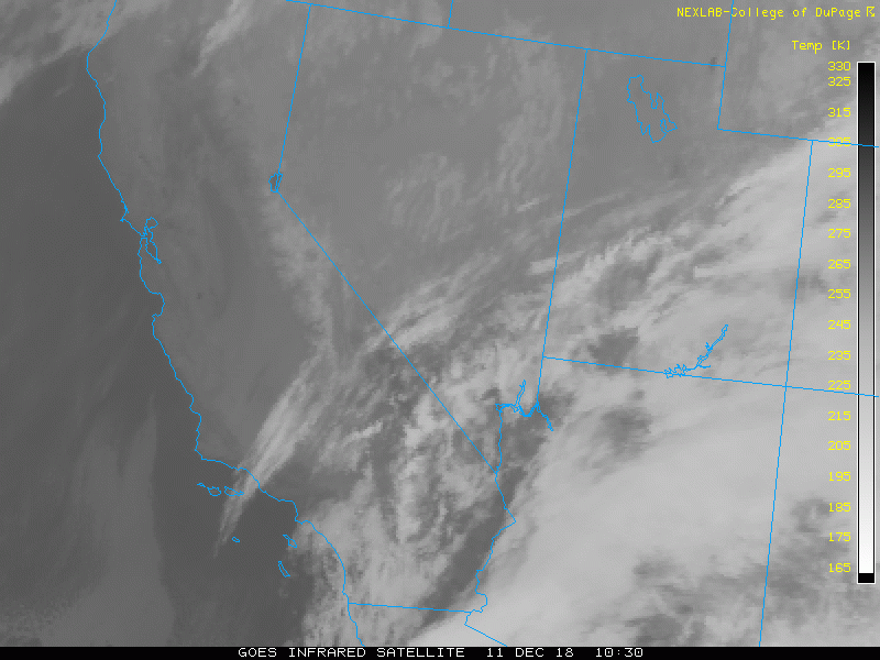
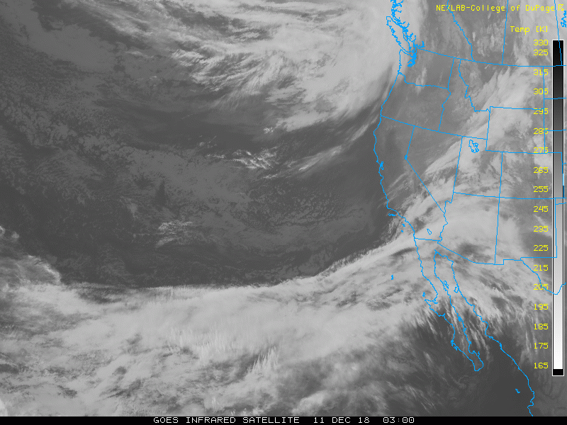
A small but potent storm system will dive out of the Gulf of Alaska and move into our area on Christmas Day (seen on the satellite loop below).

Patches of light rain and drizzle will develop Monday night around midnight. Showers and isolated downpours will then be possible Tuesday morning and last into early Tuesday afternoon. The atmosphere will be somewhat unstable, so there could be a random rumble of thunder. The rain chance quickly diminishes after sunset. Rain totals will range from 0.25" to 0.75" (map below).

Snow levels will be 7,000 to 8,000 feet on Tuesday morning, then drop to 5,500 to 6,500 Tuesday evening. So the top of Cuyamaca could see a little snow.

I'm still expecting cool air to descend into our area for the rest of the week, with Friday being the coldest so far this season. In fact, latest data is showing a reinforcing blast of cold air arriving on New Year's. I'll bring more updates as the front approaches.


NEXT RAIN CHANCE SAN DIEGO: UPDATED TUESDAY 12-18-2018

A big shift in the weather pattern is headed this way.  Temperatures will remain mild for the next couple days, then a front will pass the area on Friday and push our temperatures down a tad for the weekend.

A much more powerful system will move in on Christmas Day. Scattered showers will be possible Tuesday and into Wednesday. Moisture is limited with this system, so I'm not expecting a lot of rain. Snow levels will be fairly low, so some local mountains will see some snow.

The biggest story will be the cold air moving in for the rest of next week. You can see on the maps below how cold air overspreads the entire Western United States. It will be the coldest of the season and will probably persist for the rest of December.

This is still several days out, so I'll keep watching the pattern develop and bring updates when necessary.

Computer Forecast Christmas Day

Computer Forecast Friday 12-28-2018

SAN DIEGO RAIN TOTALS: MONDAY 12-17-2018

La Jolla Amago (LJOC1)0.02
Ramona (RNM)0.02
Palomar Mountain CRS (PMMC1)0.01
Rincon Springs (RINC1)0.01
San Pasqual (PSQC1)0.01

NEXT RAIN CHANCE SAN DIEGO: UPDATED MONDAY 12-17-2018

There is still a slight chance for a few showers late this afternoon and into early tonight. The front is weak and there isn't much moisture associated with this system, so rain amounts will be low...if you see any.

I'm also watching for a slight chance for rain early next week. It doesn't look like a major storm, but still worth tracking.

NEXT RAIN CHANCE SAN DIEGO: UPDATED TUESDAY 12-11-2018

Over the past few days I've been closely watching out over the Pacific Ocean. The weather pattern is extremely disorganized right now. There are several small systems, including one that is overhead our area this morning. You can see clouds in our area in the first two satellite images below.

Unfortunately this system isn't too strong. There also isn't much moisture available to produce any instability or rain. You can see on the third satellite loop below that all the moisture (indicated by blue, green and red) is staying bottled up in the tropics. Chances for rain today are extremely slim. I'm expecting skies to clear this afternoon and evening.

We will see the same thing happen on Friday and then again next Sunday/Monday. Storm systems will approach our area and weaken, so we will see clouds, but probably no rain. Right now I'm leaving the rain chances at 20% for both days, but that might be generous.

Ultimately we will need to see a shift in the weather pattern to allow a deeper and stronger storm to bring rain back to San Diego.


SAN DIEGO RAIN TOTALS: WEDNESDAY 12-5-2018 TO THURSDAY 12-6-2018

Here are the 2 day rain totals at 7 AM Friday. This was an impressive rainfall for the metro area!


Alpine (ANEC1)1.23
Barona (BNAC1)1.38
Barrett Junction (BAJC1)1.39
Birch Hill (IRCC1)2.16
Bonita (BTAC1)3.37
Bonsall (BOSC1)1.96
Brown Field (SDM)1.69
Cactus County Park (CCPC1)1.30
Camp Pendleton (NFG)1.93
Cuyamaca Reservoir (CYDC1)1.67
Deer Springs (DRGC1)1.88
Descanso (DENC1)1.35
Descanso RS (DSCC1)1.41
Echo Dell (ECDC1)1.25
El Cajon (LCKC1)1.51
El Camino Del Norte (ECMC1)0.82
El Capitan Dam (ELPC1)1.47
Encinitas (ENCC1)1.05
Escondido (ESOC1)1.22
Fashion Valley (FSNC1)2.19
Flinn Springs (FLYC1)1.55
Goose Valley (GOSC1)1.52
Granite Hills (GRHC1)1.52
Harbison Canyon (HARC1)1.53
Henshaw Dam (HAWC1)2.12
Julian (JLNC1)1.65
Julian (JULC1)1.48
Kearny Mesa (KEAC1)2.40
La Jolla Amago (LJOC1)1.57
La Mesa (LMSC1)2.45
Lake Hodges (HODC1)1.24
Lake Murray (MUYC1)2.40
Las Flores (LSFC1)1.60
Lindbergh Int'l Airport (SAN)2.60
Marron Valley (MAVC1)1.06
Mesa Grande (MEGC1)2.10
Miramar Lake (MMRC1)2.25
Mission Valley (BVDC1)3.32
Montgomery Field (MYF)2.40
Mt Woodson Rd - Ramona (RMAC1)1.52
Oceanside (OCNC1)2.81
Oceanside (OKB)2.51
Palomar Airport (CRQ)1.44
Palomar Airport (PLMC1)1.47
Palomar Mountain CRS (PMMC1)1.85
Pine Hills (PIHC1)1.24
Pine Hills Fire Station (PHIC1)1.21
Point Loma (L13)1.72
Potrero (PRCC1)0.95
Poway (PWYC1)1.54
Ramona (RMNC1)1.25
Ramona (RNM)1.35
Rancho Bernardo (RNBC1)1.60
Rincon Springs (RINC1)1.02
Roads Division 1 HQ (RDHC1)2.31
San Diego Estates (ESTC1)1.30
San Marcos Cnty Rd Stn (SMXC1)1.59
San Marcos Landfill (NMLC1)0.89
San Miguel (MIGC1)2.46
San Pasqual (PSQC1)1.56
San Ysidro (YSDC1)1.61
Santa Ysabel (SYSC1)1.47
Santee - Mast Rd (STEC1)2.46
Skyline Ranch (SKLC1)1.41
Sutherland Dam (SUDC1)1.21
Tijuana Estuary (TJEC1)2.14
Tijuana R - Int'l Bndry (TIJC1)1.30
Valley Center (VALC1)1.22
Volcano Mountain (VCNC1)1.65
Warner Springs (WSGC1)1.46
Wire Mountain (WIRC1)2.40
Witch Creek Fire Stn (WCHC1)1.53
Wohlford Dam (WHLC1)1.07


NEXT RAIN CHANCE SAN DIEGO: UPDATED MONDAY 12-3-2018

There are no big changes with the forecast for this next round of rain. The storm system is easily spotted on the first satellite loop below.

I'm expecting rain to move into our area between 9 AM and 12 PM Wednesday. Periods of rain will persist into Wednesday night and through the day on Thursday. The atmosphere will become unstable as the core of the system passes overhead on Thursday. Isolated thunderstorms will be possible late Thursday morning into Thursday evening. This brings the potential for heavy rain for some areas. Also, there is a mild atmospheric river with this system, which enhances the rain amounts (second loop below).

Rain totals could range from 1 to 2" with isolated areas getting more, especially in the mountains (map below). Snow levels will be above 8,000 so I'm not expecting snow in local mountains. However, the Sierra's to the north will get another significant snowfall (map projections below).


SAN DIEGO RAIN TOTALS: SATURDAY 12-1-2018


Alpine (ANEC1)0.08
Barona (BNAC1)0.01
Barret Lake (BRTC1)0.00
Barrett Junction (BAJC1)0.02
Birch Hill (IRCC1)0.03
Bonita (BTAC1)0.00
Bonsall (BOSC1)0.02
Brown Field (SDM)0.02
Cactus County Park (CCPC1)0.00
Camp Pendleton (NFG)0.00
Cuyamaca Reservoir (CYDC1)0.33
Deer Springs (DRGC1)0.02
Descanso (DENC1)0.25
Descanso RS (DSCC1)0.25
Dulzura Summit (DULC1)0.00
Eastern Tanks (ETKC1)0.00
Echo Dell (ECDC1)0.10
El Capitan Dam (ELPC1)0.23
Encinitas (ENCC1)0.00
Escondido (ESOC1)0.07
Fashion Valley (FSNC1)0.00
Flinn Springs (FLYC1)0.00
Goat Canyon (GOCC1)0.00
Goose Valley (GOSC1)0.07
Granite Hills (GRHC1)0.00
Harbison Canyon (HARC1)0.00
Henshaw Dam (HAWC1)0.05
Julian (JLNC1)0.16
Julian (JULC1)0.20
Kearny Mesa (KEAC1)0.00
La Jolla Amago (LJOC1)0.00
La Mesa (LMSC1)0.01
Lake Hodges (HODC1)0.01
Lake Murray (MUYC1)0.00
Las Flores (LSFC1)0.01
Lindbergh Int'l Airport (SAN)0.00
Marron Valley (MAVC1)0.00
Mesa Grande (MEGC1)0.07
Miramar Lake (MMRC1)0.02
Miramar Marine Corps Stn (NKX)0.00
Mission Valley (BVDC1)0.00
Montgomery Field (MYF)0.01
Mt Woodson Rd - Ramona (RMAC1)0.05
Oceanside (OCNC1)0.00
Oceanside (OKB)0.01
Otay Mountain (OTYC1)0.04
Palomar Airport (CRQ)0.01
Palomar Airport (PLMC1)0.00
Palomar Mountain CRS (PMMC1)0.03
Pine Hills (PIHC1)0.27
Pine Hills Fire Station (PHIC1)0.28
Point Loma (L13)0.00
Potrero (PRCC1)0.03
Potrero CDF (POTC1)0.05
Poway (PWYC1)0.05
Ramona (RMNC1)0.13
Ramona (RNM)0.07
Rancho Bernardo (RNBC1)0.01
Red Gate Repeater (RGPC1)0.00
Rincon Springs (RINC1)0.00
Roads Division 1 HQ (RDHC1)0.00
San Diego Estates (ESTC1)0.16
San Marcos Cnty Rd Stn (SMXC1)0.04
San Marcos Landfill (NMLC1)0.00
San Miguel (MIGC1)0.01
San Pasqual (PSQC1)0.12
San Ysidro (YSDC1)0.00
Santa Ysabel (SYSC1)0.07
Santee - Mast Rd (STEC1)0.00
Skyline Ranch (SKLC1)0.02
Smugglers Gulch (UGGC1)0.00
Sutherland Dam (SUDC1)0.03
Tijuana Estuary (TJEC1)0.00
Tijuana R - Int'l Bndry (TIJC1)0.00
Vallecitos Repeater (VCIC1)0.00
Valley Center (VALC1)0.01
Valley Center (VLCC1)0.00
Volcano Mountain (VCNC1)0.12
Warner Springs (WSGC1)0.02
Wire Mountain (WIRC1)0.04
Witch Creek Fire Stn (WCHC1)0.09
Wohlford Dam (WHLC1)0.02

NEXT RAIN CHANCE SAN DIEGO: UPDATED SATURDAY 12-1-2018

We will have a quick chance for a shower or two this afternoon and early tonight (4 PM to 1 AM). The chance for rain diminishes tonight and Sunday will be dry and cool. Rain totals will be low: less than 0.1" for coastal/inland areas, and near 0.25" in the mountains. Snow levels will drop as low as 6,000 feet, so the top of Cuyamaca could see a little snow.

I'm watching a bigger system brewing in the Gulf of Alaska. There is a ton of jet stream energy bottled up there (seen on the satellite loop below). Eventually this will organize into a storm system that will dive into our area for next workweek.

I'm expecting showers and isolated downpours to develop Wednesday and persist into early Thursday. The system is still far away, so the forecast will need some fine tuning in the coming days. Regardless, the stormy weather pattern persists, which is great news!


FORECAST

HOURLY TEMPERATURE FORECAST

COAST INLAND

BLOG ARCHIVE