
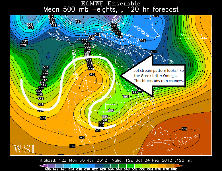
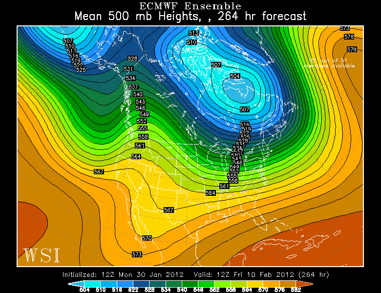
You can spot the Omega-shaped ridge on the first map below. The second map shows this pattern eroding by Friday, February 10, but I remain skeptical. Once a pattern like this develops, it takes a long time for it to break down. Regardless, we could see rain return by mid to late February.
Lastly, with such a calm pattern, foggy nights/mornings will return to the coast.
No comments:
Post a Comment